Animate:
ON | OFF
Switch Channel:
Visible
True Color
Infrared
WV: Upper | Mid | Lower Atm
Switch Domain:
Full Disk
NE Pacific
Hawaii Wide View
State of Hawaii
Overlay:
Not Available for this Channel
Download Sequence
Return to Main Satellite Page
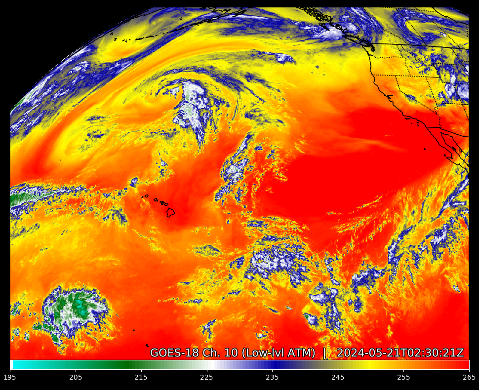
Channel 10: The 'Lower-level' Water Vapor band - 7.3 µm (micrometers).
This channel peers deepest into the atmosphere. Unless higher-level clouds obscure the view, this band can view as low as 750 mb level (about 8,000 feet/2,400 meters). As such, it is useful to view and estimate lower-level moisture and jet streaks (small areas embedded in the jet stream that can lead to severe weather). It can also be used to highlight volcanic plumes that are rich in sulfur dioxide (SO2).
The satellites do not directly detect moisture but instead detect temperature. Water vapor absorbs radiation at these particular frequencies, and thus the satellite does not sense much radiation when there is high water vapor. It records this as a low temperature, which is interpreted as high water vapor content. When radiation is not absorbed and thus received by the satellite, it senses a high temperature and consequently interprets a low amount of water vapor.
As a result, the depth at which the satellite peers into the atmosphere will vary with the amount of moisture over any particular point from day to day.
GOES-West Channel Description courtesy of National Oceanic Atmospheric Administration (NOAA)